 .
. 
See here for additional maps
The site where Jewsons has recently closed (2024) and the adjacent one at Holmere Bungalow has a complex and interlinked history based around Brian Snelgar's grandfather, father and Brian himself.
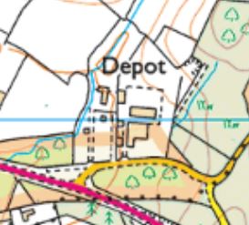
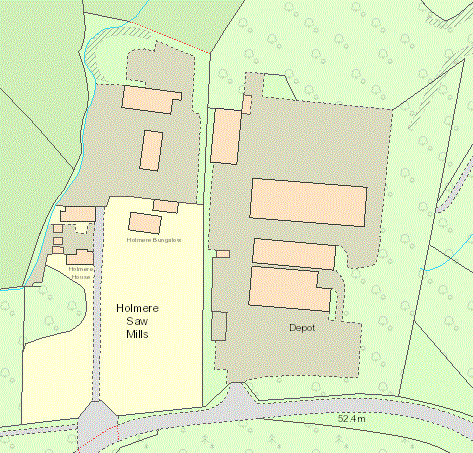
Brian's grandfather and grandmother moved from Fritham to what may have been an already established brickworks, a field already known as the Kiln Ground in 1842. While nothing is shown on the 1876 map, a brick works and brick kiln are shown on the 1901 map (see below). He made specialist bricks using clay from the area in front of and behind Holmere Bungalow in kilns just north of the bungalow. The open Scotch kilns used were banned during the Second World War as they provided landmarks for night attacks, and the family started Earldom's Sawmill alongside the bungalow on what is now the Jewsons site. This part of their land was then sold as a going sawmill business in the 1970's and the Snelgars started a new sawmill alongside it with a new name, Holmere Sawmill. Both sawmills were operating in 1966 as shown on the map below.
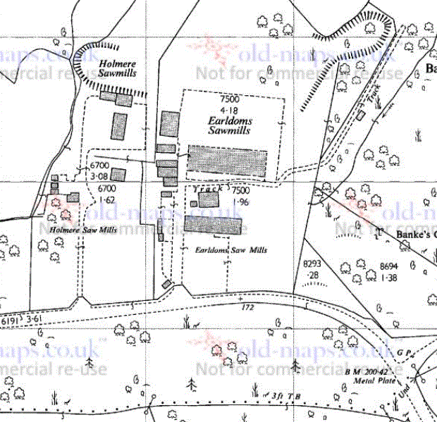
Earldoms Sawmills and Holmere Sawmills in 1966
The area in which Holmere Bungalow is situated was labelled as The Kiln Ground in the 1842 Tithe Award, and Chadwell Brick Kiln was nearby to the west at Chadwell Farm. The 1901 OS map probably predates Brian's grandfather moving to the site, in which case it would seem likely that he had bought (or joined) a brickworks that was already in operation. The Scotch kiln, or updraught kiln, was a permanent structure made of bricks with an open top. Isle of Wight History Centre is a good general reference and there are more details here, but not available on the public version of this website.

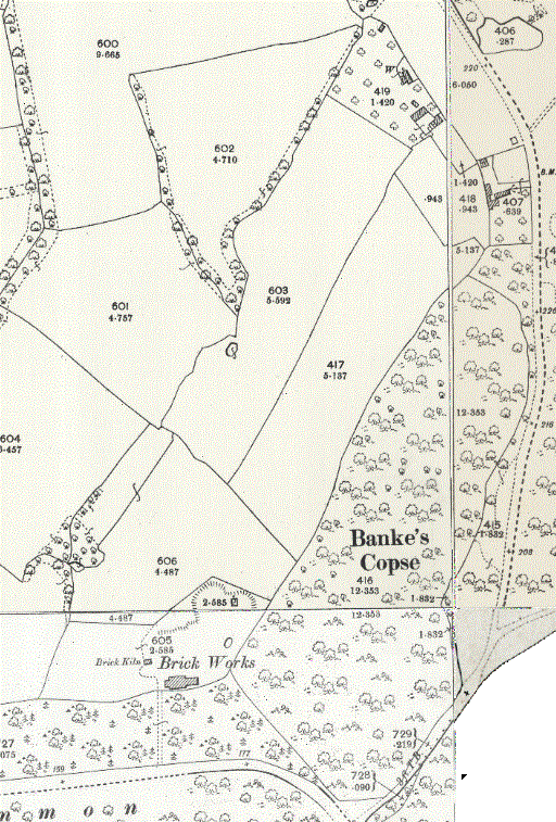
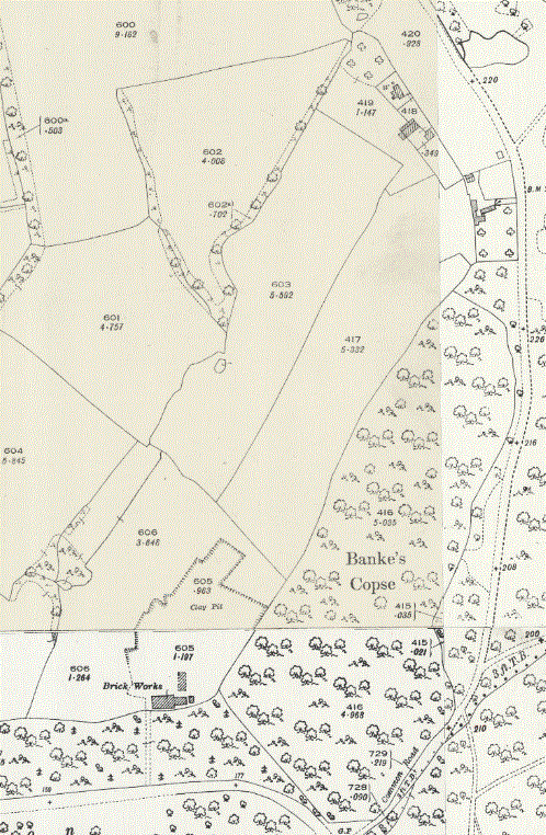
The area in 1842, 1844-1888 1st edition OS, 1901 2nd edition OS, 1898-1939 3rd edition OS
For a clearer view of any map or image, right click and select 'open in new tab' or 'open in new window'
Both the Earldoms and Holmere names come from the land immediately across the road from the site, Holmere Common immediately across the road and stretching to the west along the far side of the line of the old A36, now Old Southampton Road at that point, and Earldoms, the nearest point of which is just 70 metres away to the south across Holmere Common. It is worth being aware that Holmere Cottage is separate from Holmere Bungalow and Holmere House, a kilometre (half a mile) west along the A36, and recently renamed as Chadwell.
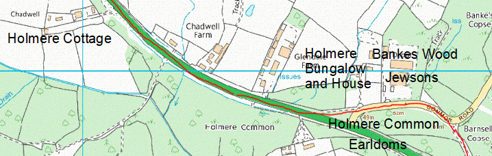
Places associated with the paragraph above - Holmere Cottage, Bungalow and House, Jewsons, Holmere Common and Earldoms
The old line of the A36 is shown in red
Later, Brian and his father started Holmere Transport, Brian driving lorries mainly at night to avoid inconvencing other road uses. Meanwhile Earldom's Sawmills went on to be sold to Reeves in the 1970s and opened as a builders merchant. This business continued when Reeves was bought by the Graham Group, trading for a time as Graham-Reeves and then as Graham, which went into liquidation in 2010 and was dissolved in 2016. The builder's merchant business continued under Jewson until closure in 2024 (by June), when the site was put up for sale. As of 31st December 2024 the site is still being advertised for sale.
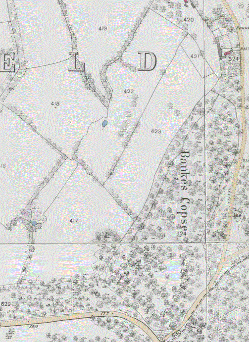
In addition to The Kiln Ground, the Snelgars owned Banke's Copse, shown as Bankes Wood on the 1842 Tithe map as parcel 897, owned and occupied by Countess Nelson, nee Frances Elizabeth Eyre (Brickworth House). Selling Earldoms Sawmill left them with two disconnected pieces of land, the one at Holmere Sawmill (now Holmere Bungalow), and the other Bankes Copse. About 1950 Brian's father purchased the field behind the bungalow to provide a reserve of clay in case they wanted to return to brickmaking, and The Acre Field to reconnect the Holmere Bungalow site with Bankes Copse. Much more detail of the Snelgars' businesses is covered by other pages on this website through the links above and summarised at the foot of this page, although not all are yet available on the public version of this website. Do contact me if you would like specific pages uploaded.
/Bankes%20Copse%20(OS%20copyright%202018).jpg)
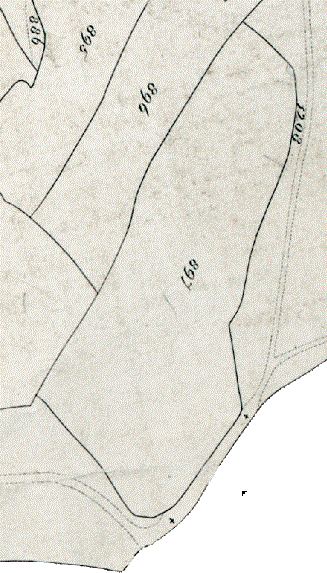
LEFT: Bankes Wood is parcel 897 on this 1842 Tithe Map extract
RIGHT: Modern map (not visible on the public version of this website for copyright reasons)
- Earldoms brickworks started by Brian Snelgar's grandfather when he moved to Whiteparish from Fritham
- Earldoms Sawmill started on what is now Jewsons by Brian Snelgar's father/grandfather
- The sawmill was sold as a going business (1970s - was this the transaction to Reeves below, or was there an intermediate owner?)
- After this, Brian Snelgar's father set up Holmere Sawmill on the next plot and later he and Brian started Holmere Transport.
- The Holmere Sawmill site was sold in the 1970s to Reeves, a large builder's merchant, for £16,000 (Whiteparish 100 years says sold to Graham Reeves but I believe the purchase by Graham Group came later)
- From memory it traded as Reeves initially, later bought by the Graham Group and rebranded initially to Graham Reeves and later to Graham. Whiteparish 100 Years page 153 has an aerial photograph of the site in the mid 1990s. Graham Builders Merchants, company number 00066738 may have been this company, dissolved in 2016 Companies House
- 1999 The business was sold by Graham-Reeves (Graham) to Jewsons and continued as a builders merchant
- Jewsons closed in 2024 (by June 2024) and the site was put up for sale, still being for sale at the close of 2024.
There was a company Graham-Reeves Limited, a Private Limited Company established on 8th January 1936 and dissolved on 13th July 2010 (see Companies House), when it went into liquidation, but Graham Builders Merchants listed above is a more likely match. Modern companies with similar names don't seem to be related in any way. Jewson was acquired by the French conglomerate Saint-Gobain in April 2000, having only existed as an independent company bearing the name Jewson for a few months in 1983, and having progressed through the names Gabriel Wade (Western) Limited, Crundall Payne Limited, Jewson Limited, Meyer International Merchants Limited. If this is the right company, it may be better thought of as a trading name rather than company. I am still researching the companies Reeves/Graham/Jewson, so use these details cautiously as some of the details here may be incorrect. This page will be updated as more certain facts are established.
See Banke's Copse for further details of the history of this plot and the various businesses that have been run there.
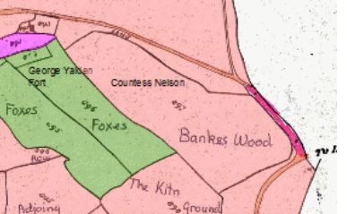
Ownership of land in 1842 (north is to the left of this map)
Pale pink: owned and occupied by the Countess Nelson of Brickworth House, later of Trafalgar House
Green: owned by George Yalden Fort and farmed by James Barter (see Barters Farm)
Bright Pink: owned and occupied by James Barter
Map taken from here
Summary of related links
- Brickworks, introduction to the four brickworks in the parish (also see their individual links below)
- Earldoms Brickworks, 1901, 1925, closed 1939
- Chadwell Brick Kiln, at Chadwell Farm, 1811
- Whiteparish Brickworks, just south of the church 1842, 1876
- Cowesfield Brickworkds, on Cowesfield Road where Yew Tree Farm is today, 1842, 1896, 1901, 1909, [1926?]
- Banke's Copse summarises all the businesses run in this area. Most of this information is now also on this page.